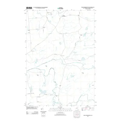
2013 Map of West Pierrepont
USGS Topo · Published 2013About this map
The Grass River and its various branches, including the N Br Grass River and Middle Br Grass River, carve a complex drainage pattern across this section of Saint Lawrence County. A distinctive network of "corners" settlements—historical intersections named for local families—defines the rural geography, ranging from Endersbees Corners and Van House Corners in the north to Reynolds Corners and Coopers Corners in the south. The landscape is characterized by its hydrological features, most notably the significant drops at Lampsons Falls and Pelkys Falls.
Find a feature on this map
68 named features on this map. Tap any name to fly to it.
Don’t see what you’re looking for? This feature index may not catch every label — zoom into the map to look around manually.
Map Details
Editions of this 2013 West Pierrepont Map
This is the sole edition of this map. No revisions or reprints were ever made.
Other maps of this area

1908 · Potsdam
USGS Topo · 1:62,500

1910 · Canton
USGS Topo · 1:62,500

1911 · Canton
USGS Topo · 1:62,500

1915 · Russell
USGS Topo · 1:62,500

1918 · Russell
USGS Topo · 1:62,500

1921 · Stark
USGS Topo · 1:62,500

1923 · Stark
USGS Topo · 1:62,500

1940 · Stark
USGS Topo · 1:62,500
1943 · Colton
USGS Topo · 1:31,680
1944 · Canton
USGS Topo · 1:62,500