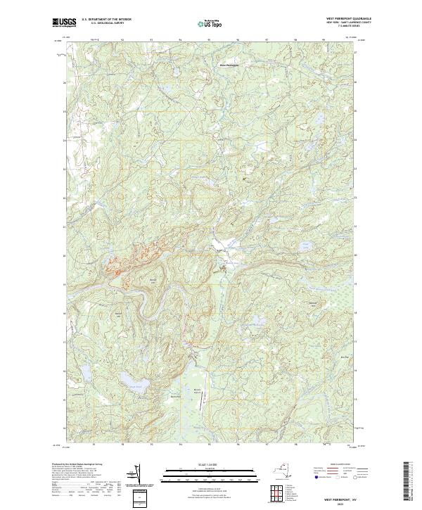
2023 Map of West Pierrepont
USGS Topo · Published 2023About this map
West Pierrepont serves as the primary settlement in this corner of St. Lawrence County, situated where the northern foothills of the Adirondacks meet the Grass River watershed. The landscape is defined by the descent of water toward the St. Lawrence Valley, evidenced by notable drops at Lampson Falls, Harper Falls, and Pelkys Falls. Within the Adirondack Park Preserve, a network of modern recreation paths like Grandma's Climb Trl and Bucky's Loop Trl wind through the timbered terrain. This 2023 survey illustrates a rural landscape where traditional settlements like Elm Flat and Burns Flat persist alongside remote landmarks such as Moores Airport and the high points of Barbour Hill and Backus Hill. The transition from upland ponds like Boyd Pond and Clear Lake to the meandering branches of the river system highlights the region's enduring drainage patterns.
Find a feature on this map
77 named features on this map. Tap any name to fly to it.
Don’t see what you’re looking for? This feature index may not catch every label — zoom into the map to look around manually.
Map Details
Editions of this 2023 West Pierrepont Map
This is the sole edition of this map. No revisions or reprints were ever made.
Other maps of this area

1908 · Potsdam
USGS Topo · 1:62,500

1910 · Canton
USGS Topo · 1:62,500

1911 · Canton
USGS Topo · 1:62,500

1915 · Russell
USGS Topo · 1:62,500

1918 · Russell
USGS Topo · 1:62,500

1921 · Stark
USGS Topo · 1:62,500

1923 · Stark
USGS Topo · 1:62,500

1940 · Stark
USGS Topo · 1:62,500
1943 · Colton
USGS Topo · 1:31,680
1944 · Canton
USGS Topo · 1:62,500