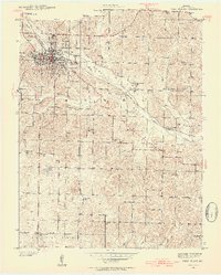
1938 Map of West Plains
USGS Topo · Published 1954About this map
West Plains serves as the bustling hub of Howell County in the late 1930s, anchored by the St Louis San Francisco railroad and a grid of residential and industrial streets. The landscape beyond the city limits is defined by a dense network of rural infrastructure, including a notable concentration of neighborhood schools such as Oakgrove Sch, Langston Sch, and Greenwood Sch. This survey provides a rare view of the County Home and its adjacent County Cem, reflecting the social services of the era. The terrain is shaped by the winding course of Howell Creek and Chapin Branch, which dictated the early settlement patterns and the placement of country churches like Smith Chapel. Genealogists will find particular value in the clearly marked family-named landmarks and cemeteries scattered across the South Fork and Howell Valley regions.
Find a feature on this map
35 named features on this map. Tap any name to fly to it.
Don’t see what you’re looking for? This feature index may not catch every label — zoom into the map to look around manually.
Map Details
Editions of this 1938 West Plains Map
3 editions found
Other maps of this area

1938 · West Plains
USGS Topo · 1:24,000

1940 · West Plains
USGS Topo · 1:24,000

1943 · Thayer
USGS Topo · 1:62,500

1944 · West Plains
USGS Topo · 1:62,500

1945 · Willow Springs
USGS Topo · 1:62,500

1945 · Montier
USGS Topo · 1:62,500

1946 · Thayer
USGS Topo · 1:62,500

1946 · West Plains
USGS Topo · 1:62,500

1948 · Montier
USGS Topo · 1:62,500

1948 · Willow Springs
USGS Topo · 1:62,500