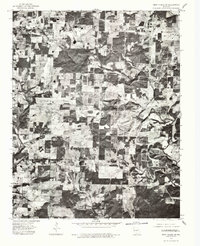
1976 Map of West Plains SW
USGS Topo · Published 1977About this map
Moody sits within a mosaic of agricultural clearings and woodland patches in this Missouri landscape near the Arkansas border. This orthophotoquad, derived from 1976 aerial photography, reveals the precise field patterns and rural road networks of Howell County during the mid-1970s. The terrain is defined by the winding course of the Spring River, which carves through the eastern portion of the sheet. Unlike standard topographic maps, this imagery provides a direct visual record of land use, showing the exact extent of timber and pasture that shaped the local economy and settlement patterns at the time.
Find a feature on this map
2 named features on this map. Tap any name to fly to it.
Don’t see what you’re looking for? This feature index may not catch every label — zoom into the map to look around manually.
Map Details
Editions of this 1976 West Plains SW Map
This is the sole edition of this map. No revisions or reprints were ever made.
Other maps of this area

1890 · Mountain Home
USGS Topo · 1:125,000

1891 · Mountain Home
USGS Topo · 1:125,000

1894 · Mountain Home
USGS Topo · 1:125,000

1938 · West Plains
USGS Topo · 1:24,000

1940 · West Plains
USGS Topo · 1:24,000

1944 · West Plains
USGS Topo · 1:62,500

1944 · Cureall
USGS Topo · 1:62,500

1945 · Harrison
USGS Topo · 1:250,000

1946 · West Plains
USGS Topo · 1:62,500

1946 · Cureall
USGS Topo · 1:62,500