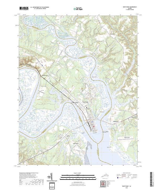
2022 Map of West Point
USGS Topo · Published 2022About this map
The confluence of the Mattaponi River and the Pamunkey River defines this riverine landscape, where the York River begins at the tip of West Point. This modern survey details the intricate network of waterways and marshes, such as Hill Marsh and Eltham Marsh, that have historically shaped transport and settlement patterns at the tip of the Virginia Peninsula. The grid of West Point is established alongside neighboring Port Richmond and Eltham, illustrating the concentrated development at this strategic nautical junction.
Find a feature on this map
112 named features on this map. Tap any name to fly to it.
Don’t see what you’re looking for? This feature index may not catch every label — zoom into the map to look around manually.
Map Details
Editions of this 2022 West Point Map
This is the sole edition of this map. No revisions or reprints were ever made.
Other maps of this area

1906 · Williamsburg
USGS Topo · 1:62,500

1917 · Urbanna
USGS Topo · 1:62,500

1917 · Toano
USGS Topo · 1:62,500

1918 · Toano
USGS Topo · 1:62,500

1919 · New Kent
USGS Topo · 1:62,500

1943 · Richmond
USGS Topo · 1:250,000
1949 · Truhart
USGS Topo · 1:24,000

1949 · Shacklefords
USGS Topo · 1:24,000
1949 · King And Queen
USGS Topo · 1:24,000
1949 · Samos
USGS Topo · 1:24,000