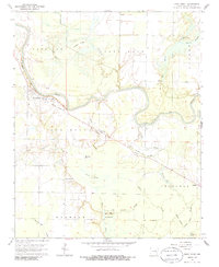
1964 Map of West Point
USGS Topo · Published 1986About this map
The Little Red River defines the landscape of this Arkansas lowlands survey, snaking through a complex network of sloughs and brakes. The settlement of West Point serves as a primary hub, showing a High Sch and Pumping Station situated near the riverbanks. The era is marked by a shift in transportation, visible in the Old Railroad Grade that cuts diagonally across the terrain toward Pryor, tracing a line of commerce that once connected these river towns.
Find a feature on this map
39 named features on this map. Tap any name to fly to it.
Don’t see what you’re looking for? This feature index may not catch every label — zoom into the map to look around manually.
Map Details
Editions of this 1964 West Point Map
2 editions found
Other maps of this area

1932 · Kensett
USGS Topo · 1:62,500

1935 · Kensett
USGS Topo · 1:62,500

1935 · Augusta
USGS Topo · 1:62,500

1935 · Gregory
USGS Topo · 1:62,500

1935 · Bald Knob
USGS Topo · 1:62,500

1953 · Memphis
USGS Topo · 1:250,000

1956 · Memphis
USGS Topo · 1:250,000

1957 · Augusta
USGS Topo · 1:62,500

1957 · Gregory
USGS Topo · 1:62,500
1964 · Walker
USGS Topo · 1:24,000