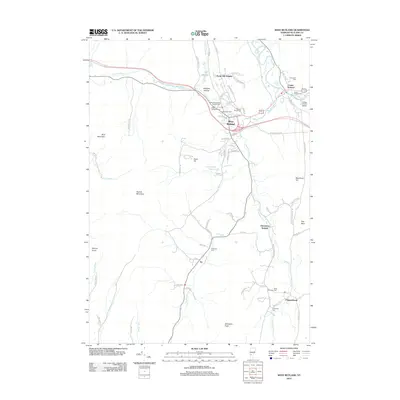
2012 Map of West Rutland
USGS Topo · Published 2012About this map
The Clarendon River and Castleton River converge near the hub of West Rutland, illustrating a landscape defined by its valley corridors and limestone heritage. This 2012 survey details a dense cluster of religious and community landmarks, including the Saint Stanislaus Kostka Cem, Saint Bridgets Cem, and Sacred Heart Cem, which speak to the area's cultural history and growth. To the east, Center Rutland sits at the falls of Otter Creek, near the College of Saint Joseph. Moving south, the terrain rises toward the summits of Herrick Mountain and Bird Mountain, while the small settlement of Ira is tucked along Ira Brook. The map provides excellent detail for genealogists, tracing numerous family-named burial grounds like Edmunds Cem and Riverside Cem that dot the rural roads connecting Chippenhook and Clarendon Springs.
Find a feature on this map
78 named features on this map. Tap any name to fly to it.
Don’t see what you’re looking for? This feature index may not catch every label — zoom into the map to look around manually.
Map Details
Editions of this 2012 West Rutland Map
This is the sole edition of this map. No revisions or reprints were ever made.
Other maps of this area

1891 · Rutland
USGS Topo · 1:62,500

1893 · Wallingford
USGS Topo · 1:62,500

1893 · Rutland
USGS Topo · 1:62,500

1894 · Pawlet
USGS Topo · 1:62,500

1895 · Castleton
USGS Topo · 1:62,500

1897 · Pawlet
USGS Topo · 1:62,500

1897 · Castleton
USGS Topo · 1:62,500

1903 · Mettawee
USGS Topo · 1:125,000

1944 · Proctor
USGS Topo · 1:31,680
1944 · Bomoseen
USGS Topo · 1:31,680