
2018 Map of West Rutland
USGS Topo · Published 2018About this map
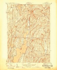
West Rutland and the neighboring hills define this landscape at the edge of the Green Mountains, where the village and Center Rutland sit at a vital intersection of water and transport. The Castleton River and Otter Creek converge here, punctuated by Center Rutland Falls, a natural point of early industrial focus. The village layout is densely packed with history, evidenced by several religious landmarks including Sacred Heart Cem, Saint Stanislaus Kostka Cem, and the campus of the College of St Joseph. Further south, the rural character of Clarendon Springs and the small settlement of Ira emerge along the banks of Ira Brook. The map reveals a transition from the structured street grids of the Rutland outskirts to the steep elevations of Herrick Mtn and Bird Mtn, illustrating how the region's development was constrained by its dramatic topography.
Find a feature on this map
80 named features on this map. Tap any name to fly to it.
Don’t see what you’re looking for? This feature index may not catch every label — zoom into the map to look around manually.
Map Details
Editions of this 2018 West Rutland Map
This is the sole edition of this map. No revisions or reprints were ever made.
Other maps of this area

1891 · Rutland
USGS Topo · 1:62,500

1893 · Wallingford
USGS Topo · 1:62,500

1893 · Rutland
USGS Topo · 1:62,500

1894 · Pawlet
USGS Topo · 1:62,500

1895 · Castleton
USGS Topo · 1:62,500

1897 · Pawlet
USGS Topo · 1:62,500

1897 · Castleton
USGS Topo · 1:62,500

1903 · Mettawee
USGS Topo · 1:125,000

1944 · Proctor
USGS Topo · 1:31,680
1944 · Bomoseen
USGS Topo · 1:31,680