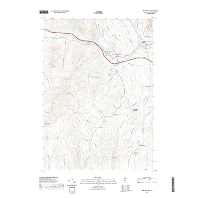
2021 Map of West Rutland
USGS Topo · Published 2021About this map
West Rutland and Center Rutland sit at the northern edge of this Vermont landscape, where the Castleton River and Otter Creek converge near the Vermont Railway corridor. The area's settlement history is reflected in a high concentration of religious and community sites, including Saint Stanislaus Kostka Cem, Sacred Heart Cem, and Saint Bridgets Cem in the town center, along with the College of St Joseph nearby. To the south, the terrain rises sharply toward Herrick Mtn and Bird Mtn, framing the rural valley where the Clarendon River passes through Clarendon Springs. Local genealogists can trace family connections through numerous burial grounds like Riverside Cem in Ira or Edmunds Cem near Edmunds Peak, while researchers of industrial geography can follow the local road network connecting Chippenhook and West Clarendon.
Find a feature on this map
90 named features on this map. Tap any name to fly to it.
Don’t see what you’re looking for? This feature index may not catch every label — zoom into the map to look around manually.
Map Details
Editions of this 2021 West Rutland Map
This is the sole edition of this map. No revisions or reprints were ever made.
Other maps of this area

1891 · Rutland
USGS Topo · 1:62,500

1893 · Wallingford
USGS Topo · 1:62,500

1893 · Rutland
USGS Topo · 1:62,500

1894 · Pawlet
USGS Topo · 1:62,500

1895 · Castleton
USGS Topo · 1:62,500

1897 · Pawlet
USGS Topo · 1:62,500

1897 · Castleton
USGS Topo · 1:62,500

1903 · Mettawee
USGS Topo · 1:125,000

1944 · Proctor
USGS Topo · 1:31,680
1944 · Bomoseen
USGS Topo · 1:31,680