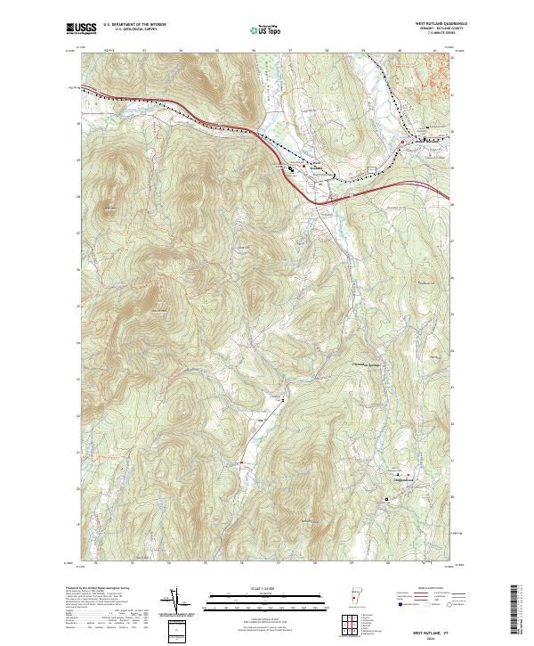
2024 Map of West Rutland
USGS Topo · Published 2024About this map
West Rutland and Center Rutland serve as the primary hubs in this landscape where the Castleton River and Otter Creek meet. The area is defined by its significant collection of community landmarks, particularly the cluster of cemeteries such as Saint Stanislaus Kostka Cem, Sacred Heart Cem, and Evergreen Cem that reflect the deep-rooted settlement history of the region. To the south and west, the terrain rises toward peaks like Bird Mtn and Herrick Mtn, separated by the drainage of Whipple Hollow. Small hamlets like Ira and Chippenhook are situated along the valley floors, connected by a network of rural roads such as Clarendon Rd and Walker Mountain Rd. The presence of the College of St Joseph and Saint Bridgets Ch highlights the institutional character of the Rutland area, while the Youngs Brook Reservoir provides a notable water feature tucked into the hills.
Find a feature on this map
80 named features on this map. Tap any name to fly to it.
Don’t see what you’re looking for? This feature index may not catch every label — zoom into the map to look around manually.
Map Details
Editions of this 2024 West Rutland Map
This is the sole edition of this map. No revisions or reprints were ever made.
Other maps of this area

1891 · Rutland
USGS Topo · 1:62,500

1893 · Wallingford
USGS Topo · 1:62,500

1893 · Rutland
USGS Topo · 1:62,500

1894 · Pawlet
USGS Topo · 1:62,500

1895 · Castleton
USGS Topo · 1:62,500

1897 · Pawlet
USGS Topo · 1:62,500

1897 · Castleton
USGS Topo · 1:62,500

1903 · Mettawee
USGS Topo · 1:125,000

1944 · Proctor
USGS Topo · 1:31,680
1944 · Bomoseen
USGS Topo · 1:31,680