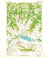
1963 Map of West Salem
USGS Topo · Published 1964About this map
West Salem sits at the heart of this landscape where the La Crosse River valley meets the complex coulees of the driftless region. In the early 1960s, the village was a busy junction of the Chicago Milwaukee St Paul and Pacific and the Chicago and North Western railroads. To the east, the La Crosse River feeds into Neshonoc Lake, a significant water feature bordered by Swarthout Park and the Neshonoc Cem. The map reveals a transition in transportation as the modern interstate era begins, with a segment of road labeled Under Construction south of the village. Numerous rural schools like Bell Coulee Sch and Walker Sch serve the outlying farming townships of Farmington and Burns, while the County Fairground and County Hospital establish West Salem as a regional hub for La Crosse County.
Find a feature on this map
48 named features on this map. Tap any name to fly to it.
Don’t see what you’re looking for? This feature index may not catch every label — zoom into the map to look around manually.
Map Details
Editions of this 1963 West Salem Map
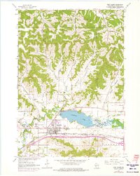
2 editions found
Other maps of this area

1909 · Sparta
USGS Topo · 1:62,500

1926 · North Bend
USGS Topo · 1:62,500

1927 · La Crosse
USGS Topo · 1:62,500

1928 · Melrose
USGS Topo · 1:48,000

1929 · North Bend
USGS Topo · 1:62,500

1930 · La Crosse
USGS Topo · 1:62,500

1947 · Sparta
USGS Topo · 1:62,500

1949 · Sparta
USGS Topo · 1:62,500

1949 · Melrose
USGS Topo · 1:62,500

1953 · Eau Claire
USGS Topo · 1:250,000