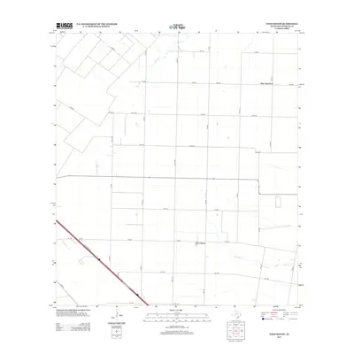
2013 Map of West Sinton
USGS Topo · Published 2013About this map
West Sinton and West Saint Paul anchor this agricultural landscape in San Patricio County, illustrating the persistent grid of rural roads and waterways that define the region's geography. The map traces the winding course of Chiltipin Cr and Aquilla Cr, which slice through a series of expansive farm plots and ranches. Infrastructure is a prominent feature, with the path of I 37 Access Rd cutting diagonally across the southwestern corner, contrasting with the rectilinear local routes such as FM-796 and FM-630. The sparse density of settlements here highlights the area's continued reliance on large-scale land use and irrigation. Researchers will find a meticulously surveyed network of county roads, including Co RD-18 and Co RD-28, which provide a clear record of property divisions and access points in this corner of the Texas Coastal Bend.
Find a feature on this map
33 named features on this map. Tap any name to fly to it.
Don’t see what you’re looking for? This feature index may not catch every label — zoom into the map to look around manually.
Map Details
Editions of this 2013 West Sinton Map
This is the sole edition of this map. No revisions or reprints were ever made.
Other maps of this area

1925 · Robstown
USGS Topo · 1:62,500

1927 · Mathis
USGS Topo · 1:62,500

1950 · Corpus Christi
USGS Topo · 1:250,000

1953 · Beeville
USGS Topo · 1:250,000

1954 · Orange Grove
USGS Topo · 1:62,500

1954 · Robstown
USGS Topo · 1:62,500

1954 · Mathis
USGS Topo · 1:62,500

1954 · Sinton
USGS Topo · 1:62,500

1956 · Corpus Christi
USGS Topo · 1:250,000

1956 · Beeville
USGS Topo · 1:250,000