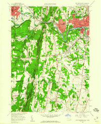
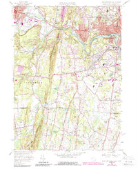
1958 Map of West Springfield
USGS Topo · Published 1960About this map
The Westfield River carves a winding path through the center of this landscape, separating the industrial and residential growth of West Springfield and Mittineague from the southern reaches of Agawam. Dominating the western horizon, the ridge of Provin Mountain stands as a prominent natural barrier, its steep slopes contrasting with the developed valley floor. The area reflects a mid-century period of suburban expansion, where residential streets in North Agawam and Westfield press against institutional landmarks like the Mother of Sorrows Monastery and the County Training School.
Find a feature on this map
80 named features on this map. Tap any name to fly to it.
Don’t see what you’re looking for? This feature index may not catch every label — zoom into the map to look around manually.
Map Details
Editions of this 1958 West Springfield Map
5 editions found
Other maps of this area

1886 · Springfield
USGS Topo · 1:62,500

1887 · Granville
USGS Topo · 1:62,500

1889 · Springfield
USGS Topo · 1:62,500

1889 · Granville
USGS Topo · 1:62,500

1892 · Hartford
USGS Topo · 1:62,500

1892 · Granby
USGS Topo · 1:62,500

1893 · Springfield
USGS Topo · 1:62,500

1893 · Granville
USGS Topo · 1:62,500

1895 · Springfield
USGS Topo · 1:62,500

1895 · Granville
USGS Topo · 1:62,500