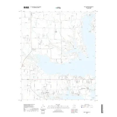
2019 Map of West Tawakoni
USGS Topo · Published 2019About this map
Lake Tawakoni dominates this landscape, defining the residential and recreational layout of Hunt County in the late 2010s. The intricate shoreline is marked by distinctive points and reaches, including Moon Head Reach, Rain Point, and Screech Owl Reach. Along the southern banks, the communities of West Tawakoni, Hawk Cove, and Quinlan are interconnected by state roads and local routes like FM 2101. For those tracing local history or family ties, several burial grounds are preserved across the area, such as Odd Fellows Cem and McBride Cem. The region's accessibility is highlighted by several private airfields, including Weese International Airport and Rockin M Airport, reflecting a mix of rural transit and lakeside development. The naming of coves like Rabbit Cove and Hickory Cove suggests a landscape closely tied to its natural geography and local heritage.
Find a feature on this map
117 named features on this map. Tap any name to fly to it.
Don’t see what you’re looking for? This feature index may not catch every label — zoom into the map to look around manually.
Map Details
Editions of this 2019 West Tawakoni Map
This is the sole edition of this map. No revisions or reprints were ever made.
Other maps of this area

1953 · Texarkana
USGS Topo · 1:250,000

1954 · Dallas
USGS Topo · 1:250,000

1954 · Sherman
USGS Topo · 1:250,000

1956 · Texarkana
USGS Topo · 1:250,000

1956 · Tyler
USGS Topo · 1:250,000

1956 · Quinlan
USGS Topo · 1:62,500

1956 · Emory
USGS Topo · 1:62,500

1958 · Dallas
USGS Topo · 1:250,000

1958 · Sherman
USGS Topo · 1:250,000

1962 · Greenville SW
USGS Topo · 1:24,000