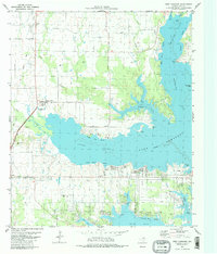
1980 Map of West Tawakoni
USGS Topo · Published 1980About this map
Lake Tawakoni dominates the central landscape of this Hunt County survey, its jagged shoreline forming numerous named reaches and coves that defined the local geography by 1980. The settlement of West Tawakoni is situated along the southern shore, showing the residential and commercial development that followed the reservoir's creation. Further inland, the map preserves older layers of rural history through family and community landmarks such as Mc Bride Cem, Kuykendall Cem, and the Odd Fellows Cem. North of the water, the landscape transitions to more agricultural and institutional uses, marked by the extensive grounds of the Boles Home and the community of Cash. This era of the lake's history reflects a balance between recreational development, seen at Wind Point Park and the lakeside Golf Course, and the persistence of traditional crossroads like Sunset Ch and the small settlement of Mexico.
Find a feature on this map
52 named features on this map. Tap any name to fly to it.
Don’t see what you’re looking for? This feature index may not catch every label — zoom into the map to look around manually.
Map Details
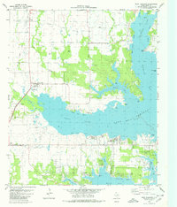
Editions of this 1980 West Tawakoni Map
2 editions found
Other maps of this area

1953 · Texarkana
USGS Topo · 1:250,000

1954 · Dallas
USGS Topo · 1:250,000

1954 · Sherman
USGS Topo · 1:250,000

1956 · Texarkana
USGS Topo · 1:250,000

1956 · Tyler
USGS Topo · 1:250,000

1956 · Quinlan
USGS Topo · 1:62,500

1956 · Emory
USGS Topo · 1:62,500

1958 · Dallas
USGS Topo · 1:250,000

1958 · Sherman
USGS Topo · 1:250,000

1962 · Greenville SW
USGS Topo · 1:24,000