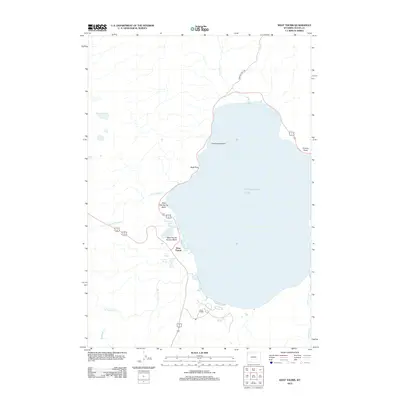
2012 Map of West Thumb
USGS Topo · Published 2012About this map
Yellowstone Lake dominates this 2012 survey, its western shoreline defined by active thermal features and the established visitor hubs of Grant Village and West Thumb. This map documents a high concentration of hydrothermal activity along the water's edge, particularly within the West Thumb Geyser Basin and Potts Hot Spring Basin. Geologists and researchers can locate specific thermal landmarks such as Abyss Pool, Overhanging Geyser, and the Twin Geysers. The landscape transitions from the deep waters near Bluff Point and Pumice Point to the intricate network of inland drainages including Arnica Cr and Little Thumb Cr. Further south, the settlement of Grant Village serves as a modern anchor near the mouth of Solution Cr, while the historic Howard Eton Trl provides a trace of backcountry travel through the northern timber.
Find a feature on this map
24 named features on this map. Tap any name to fly to it.
Don’t see what you’re looking for? This feature index may not catch every label — zoom into the map to look around manually.
Map Details
Editions of this 2012 West Thumb Map
This is the sole edition of this map. No revisions or reprints were ever made.
Other maps of this area

1885 · Lake
USGS Topo · 1:125,000

1885 · Gallatin
USGS Topo · 1:125,000

1885 · Gallatin
USGS Topo · 1:125,000

1886 · Shoshone
USGS Topo · 1:125,000

1886 · Canyon
USGS Topo · 1:125,000

1888 · Shoshone
USGS Topo · 1:125,000

1895 · Shoshone
USGS Topo · 1:125,000

1895 · Canyon
USGS Topo · 1:125,000

1895 · Lake
USGS Topo · 1:125,000

1896 · Lake
USGS Topo · 1:125,000