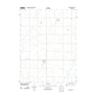
2012 Map of Westboro
USGS Topo · Published 2012About this map
Westboro and Northboro anchor this agricultural landscape along the Missouri-Iowa border, where the survey captures the intersection of rural townships and regional waterways. The Tarkio River and its tributaries, including Middle Tarkio Creek and Long Branch, define the drainage of this prairie region, which is marked by a strict section-line road grid. Local history is preserved in sites like the Washington Township Cemetery and the Houser Cemetery, reflecting the early settlement patterns of Atchison County. Small-scale infrastructure such as the Henn Landing Strip and the Northboro Post Office show the continued utility of these cross-border communities. The presence of Walkerville further illustrates the cluster of small hamlets that once supported the local farming economy during the early 21st century.
Find a feature on this map
33 named features on this map. Tap any name to fly to it.
Don’t see what you’re looking for? This feature index may not catch every label — zoom into the map to look around manually.
Map Details
Editions of this 2012 Westboro Map
This is the sole edition of this map. No revisions or reprints were ever made.
Other maps of this area

1939 · Tarkio
USGS Topo · 1:62,500

1939 · Farragut
USGS Topo · 1:62,500

1939 · Skidmore
USGS Topo · 1:62,500

1940 · Tarkio
USGS Topo · 1:62,500

1940 · Farragut
USGS Topo · 1:62,500

1940 · Coin
USGS Topo · 1:62,500

1941 · Tarkio
USGS Topo · 1:62,500

1941 · Skidmore
USGS Topo · 1:62,500

1942 · Skidmore
USGS Topo · 1:62,500

1943 · Coin
USGS Topo · 1:62,500