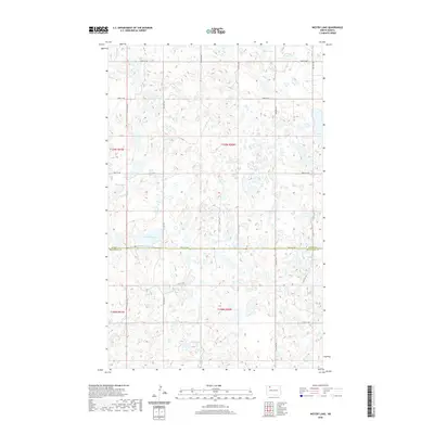
2020 Map of Westby Lake
USGS Topo · Published 2020About this map
Glacial prairie potholes and seasonal wetlands define this section of the northern Great Plains along the border of Burke and Mountrail counties. The landscape is characterized by a dense network of water bodies, ranging from the prominent Westby Lake and Hoover Lake to the elongated Ford Slough. These natural basins are separated by low rises in the terrain, reflecting the distinct geological character of the Missouri Coteau region. In the northern reaches, Blanc Lake sits amidst a scattering of smaller depressions, highlighting the intricate drainage patterns of this sparsely populated area.
Find a feature on this map
14 named features on this map. Tap any name to fly to it.
Don’t see what you’re looking for? This feature index may not catch every label — zoom into the map to look around manually.
Map Details
Editions of this 2020 Westby Lake Map
This is the sole edition of this map. No revisions or reprints were ever made.
Other maps of this area

1948 · Vanville NE
USGS Topo · 1:24,000

1949 · Mosquito Butte
USGS Topo · 1:24,000

1949 · Niobe
USGS Topo · 1:24,000

1950 · Vanville NE
USGS Topo · 1:24,000

1950 · Kenmare
USGS Topo · 1:62,500

1953 · Williston
USGS Topo · 1:250,000

1957 · Williston
USGS Topo · 1:250,000
1974 · Thompson Lake
USGS Topo · 1:24,000

1974 · Lostwood Lakes
USGS Topo · 1:24,000

1978 · Westby Lake
USGS Topo · 1:24,000