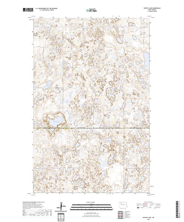
2024 Map of Westby Lake
USGS Topo · Published 2024About this map
Westby Lake and Hoover Lake anchor this landscape of glacial prairie potholes along the boundary of Burke and Mountrail Counties. The terrain is defined by a dense network of wetlands and seasonal water bodies, including Ford Slough, Stacy Slough, and Christensen Slough. These natural basins are integrated into extensive conservation tracts, most notably the Burke County Waterfowl Production Area and the Mountrail County Waterfowl Production Area. The section line road system, including 78th St NW and 80th St NW, imposes a rigid grid over the irregular topography of the Missouri Coteau. This 2024 survey captures the region's contemporary character as a critical habitat zone, where the agricultural grid of North Dakota meets protected wetlands designed for migratory bird conservation.
Find a feature on this map
17 named features on this map. Tap any name to fly to it.
Don’t see what you’re looking for? This feature index may not catch every label — zoom into the map to look around manually.
Map Details
Editions of this 2024 Westby Lake Map
This is the sole edition of this map. No revisions or reprints were ever made.
Other maps of this area

1948 · Vanville NE
USGS Topo · 1:24,000

1949 · Mosquito Butte
USGS Topo · 1:24,000

1949 · Niobe
USGS Topo · 1:24,000

1950 · Vanville NE
USGS Topo · 1:24,000

1950 · Kenmare
USGS Topo · 1:62,500

1953 · Williston
USGS Topo · 1:250,000

1957 · Williston
USGS Topo · 1:250,000
1974 · Thompson Lake
USGS Topo · 1:24,000

1974 · Lostwood Lakes
USGS Topo · 1:24,000

1978 · Westby Lake
USGS Topo · 1:24,000