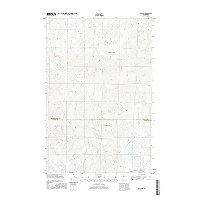
2017 Map of Western
USGS Topo · Published 2017About this map
Western sits at the northern edge of this coastal forest landscape, where the headwaters of the Johns River and Elk River systems converge. The terrain is defined by a dense network of drainage channels and creek systems, including Crawford Ditch and Ballon Cr, which flow through the timberlands of southern Grays Harbor County. Further south, the boundary between Grays Harbor Co and Pacific Co cuts through a landscape dominated by the lower reaches of the North River and the Cedar River. The complex hydrology of the region is evident in the numerous branches of the Elk River, such as the W Br Elk River and E Br Elk River, which carve through the land before reaching the coastal marshes. This 2017 survey illustrates the modern drainage and resource management patterns in a region historically vital to the Pacific Northwest timber industry.
Find a feature on this map
24 named features on this map. Tap any name to fly to it.
Don’t see what you’re looking for? This feature index may not catch every label — zoom into the map to look around manually.
Map Details
Editions of this 2017 Western Map
This is the sole edition of this map. No revisions or reprints were ever made.
Other maps of this area

1938 · Cape Shoalwater
USGS Topo · 1:62,500

1938 · South Bend
USGS Topo · 1:62,500

1940 · South Bend
USGS Topo · 1:62,500

1941 · Grayland
USGS Topo · 1:62,500

1943 · Copalis Beach
USGS Topo · 1:250,000

1951 · Copalis Beach
USGS Topo · 1:250,000

1953 · Hoquiam
USGS Topo · 1:250,000

1955 · Aberdeen SE
USGS Topo · 1:24,000
1956 · North Cove
USGS Topo · 1:24,000
1956 · Westport
USGS Topo · 1:24,000