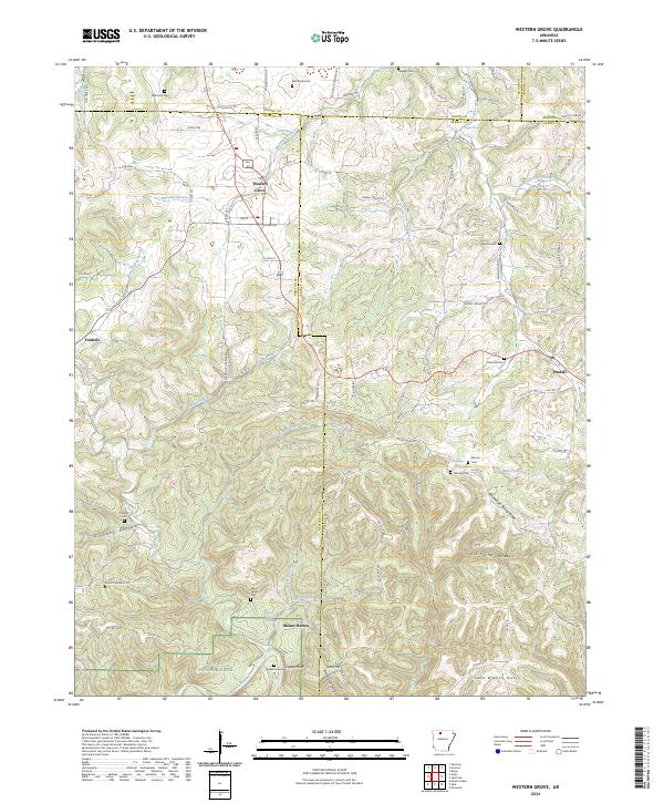
2024 Map of Western Grove
USGS Topo · Published 2024About this map
The Buffalo National River corridor dominates the southern edge of this landscape, where the waterway carves past Copper Bluff and Lead Hill. This 2024 survey documents the complex intersection of Boone, Newton, Searcy, and Marion counties, a region defined by high ridges and deep hollows like Pinhook Hollow and Cave Spring Hollow. Settlements are concentrated along the winding highway corridors, most notably Western Grove and Pindall. For those researching local heritage, the map identifies numerous family and community burial sites, including Wilbourn Cem, Mount Hersey Cem, and the Trammell Cem near the eastern boundary. The terrain transitions from the upland heights of Chinquapin Spring Ridge down to the creek-fed valleys of Davis Creek and Mill Creek, reflecting a traditional Ozark settlement pattern where homes and roads follow the high ground and fertile water gaps.
Find a feature on this map
98 named features on this map. Tap any name to fly to it.
Don’t see what you’re looking for? This feature index may not catch every label — zoom into the map to look around manually.
Map Details
Editions of this 2024 Western Grove Map
This is the sole edition of this map. No revisions or reprints were ever made.
Other maps of this area

1892 · Marshall
USGS Topo · 1:125,000

1893 · Yellville
USGS Topo · 1:125,000

1894 · Marshall
USGS Topo · 1:125,000

1901 · Marshall
USGS Topo · 1:125,000

1903 · Yellville
USGS Topo · 1:125,000

1904 · Harrison
USGS Topo · 1:125,000

1905 · Harrison
USGS Topo · 1:125,000

1905 · Yellville
USGS Topo · 1:125,000

1929 · Yellville
USGS Topo · 1:125,000

1933 · Mt Judea
USGS Topo · 1:62,500