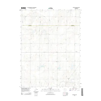
2014 Map of Western SE
USGS Topo · Published 2014About this map
The Saline and Jefferson County line divides this prairie landscape, where the agricultural grid of the early twenty-first century is punctuated by numerous small burial grounds and water management projects. Local history and genealogy are preserved in the locations of Old Plymouth Cem, Swanton Cem, and Saint Paul Cem, which serve as quiet markers of the area's rural heritage. The hydrology of the region is defined by the winding course of Swan Creek in the north and the broader basin of Cub Creek to the south. Modern infrastructure is visible through a series of flood control measures, specifically Cub Creek Reservoir 12-D, Cub Creek Reservoir 12-C, and Cub Creek Reservoir 10-A, which manage the drainage of these plains. The map provides a clear view of the section lines and rural avenues, including 574th Ave and Co Road X, that organize this part of Nebraska.
Find a feature on this map
30 named features on this map. Tap any name to fly to it.
Don’t see what you’re looking for? This feature index may not catch every label — zoom into the map to look around manually.
Map Details
Editions of this 2014 Western SE Map
This is the sole edition of this map. No revisions or reprints were ever made.
Other maps of this area

1955 · Lincoln
USGS Topo · 1:250,000

1957 · Lincoln
USGS Topo · 1:250,000

1957 · Plymouth
USGS Topo · 1:24,000

1957 · Wilber
USGS Topo · 1:24,000

1958 · Lincoln
USGS Topo · 1:250,000

1960 · Western SW
USGS Topo · 1:24,000

1960 · Fairbury
USGS Topo · 1:24,000

1961 · Western
USGS Topo · 1:24,000

1961 · Western SE
USGS Topo · 1:24,000
1961 · Swanton
USGS Topo · 1:24,000