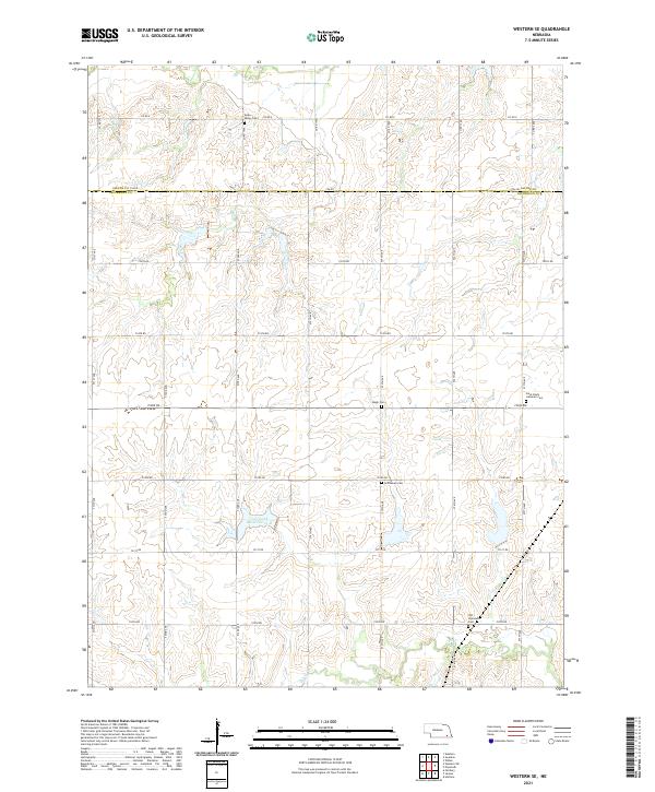
2021 Map of Western SE
USGS Topo · Published 2021About this map
The Saline and Jefferson County line divides this rural landscape of southeastern Nebraska, dominated by a grid of section-line roads and agricultural tracts. This 2021 survey illustrates a region where local heritage is preserved in several small burial grounds, including Swan Valley Cem and Saint Paul's Lutheran Cem. The terrain is shaped by the drainages of Swan Cr to the north and Cub Cr to the south, with the Cub Creek Reservoir 12-D serving as a significant water management feature. For genealogists and local historians, the placement of Emanuel Cem, Megli Cem, and Old Plymouth Cem across the township grid offers precise locations for tracing family roots in this corner of the Great Plains. The map's detail reflects the enduring township and range system, marked by townships like t4n r3e and t5n r4e.
Find a feature on this map
36 named features on this map. Tap any name to fly to it.
Don’t see what you’re looking for? This feature index may not catch every label — zoom into the map to look around manually.
Map Details
Editions of this 2021 Western SE Map
This is the sole edition of this map. No revisions or reprints were ever made.
Other maps of this area

1955 · Lincoln
USGS Topo · 1:250,000

1957 · Lincoln
USGS Topo · 1:250,000

1957 · Plymouth
USGS Topo · 1:24,000

1957 · Wilber
USGS Topo · 1:24,000

1958 · Lincoln
USGS Topo · 1:250,000

1960 · Western SW
USGS Topo · 1:24,000

1960 · Fairbury
USGS Topo · 1:24,000

1961 · Western
USGS Topo · 1:24,000

1961 · Western SE
USGS Topo · 1:24,000
1961 · Swanton
USGS Topo · 1:24,000