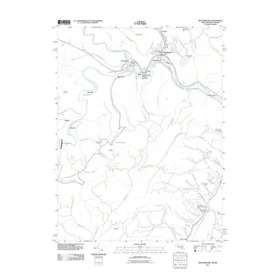
2011 Map of Westernport
USGS Topo · Published 2011About this map
The North Branch Potomac River carves a deep path through the Potomac Highlands, anchoring the industrial and residential clusters of Westernport, Piedmont, and Luke. This 2011 survey illustrates the dense infrastructure of the Tri-Towns area, where the West Virginia Central Junction and Railroad St reflect a long heritage of coal transport and paper milling. The steep topography is punctuated by Franklin Hill and Hampshire Hill, forcing development into the narrow valley floors and along winding mountain roads like Westernport Rd.
Find a feature on this map
92 named features on this map. Tap any name to fly to it.
Don’t see what you’re looking for? This feature index may not catch every label — zoom into the map to look around manually.
Map Details
Editions of this 2011 Westernport Map
This is the sole edition of this map. No revisions or reprints were ever made.
Other maps of this area

1891 · Romney
USGS Topo · 1:125,000

1895 · Piedmont
USGS Topo · 1:125,000

1898 · Frostburg
USGS Topo · 1:62,500

1899 · Grantsville
USGS Topo · 1:62,500

1901 · Frostburg
USGS Topo · 1:62,500

1904 · Grantsville
USGS Topo · 1:62,500

1908 · Frostburg
USGS Topo · 1:62,500

1919 · Elk Garden
USGS Topo · 1:48,000

1920 · Elk Garden
USGS Topo · 1:48,000

1920 · Keyser
USGS Topo · 1:62,500