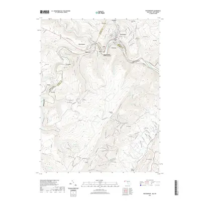
2019 Map of Westernport
USGS Topo · Published 2019About this map
The North Branch Potomac River forms the winding state boundary between Maryland and West Virginia, anchoring a corridor of industrial and residential development. Clusters of settlement at Westernport, Luke, and Piedmont reveal the area's history as a regional hub for transportation and manufacturing. Along the steep slopes of the Allegheny Front, numerous small family burial sites such as the Thomas Family Cem and Sinkler Cem are preserved, offering valuable clues for genealogists and local historians researching the early families of Garrett and Mineral counties.
Find a feature on this map
122 named features on this map. Tap any name to fly to it.
Don’t see what you’re looking for? This feature index may not catch every label — zoom into the map to look around manually.
Map Details
Editions of this 2019 Westernport Map
This is the sole edition of this map. No revisions or reprints were ever made.
Other maps of this area

1891 · Romney
USGS Topo · 1:125,000

1895 · Piedmont
USGS Topo · 1:125,000

1898 · Frostburg
USGS Topo · 1:62,500

1899 · Grantsville
USGS Topo · 1:62,500

1901 · Frostburg
USGS Topo · 1:62,500

1904 · Grantsville
USGS Topo · 1:62,500

1908 · Frostburg
USGS Topo · 1:62,500

1919 · Elk Garden
USGS Topo · 1:48,000

1920 · Elk Garden
USGS Topo · 1:48,000

1920 · Keyser
USGS Topo · 1:62,500