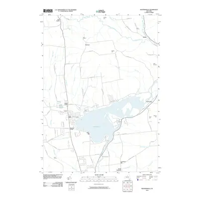
2010 Map of Westernville
USGS Topo · Published 2010About this map
Delta Reservoir dominates the central landscape of this Oneida County region, a massive water body fed by the Mohawk River and several smaller tributaries like Potash Creek and Burk Creek. The village of Westernville sits on the eastern shore, while the community of Lake Delta is positioned to the west. This 2010 map highlights a distinct collection of early burial grounds that speak to the area's ancestral settlement patterns, including the Welsh Cemetery, Polish Cemetery, and Rogers Cemetery. The local economy and infrastructure are reflected in features such as the Rome Fish Hatchery and the CMA Campground. Numerous hills such as Quaker Hill and Elmer Hill rise above the basin, framing a landscape defined by its connection to the Mohawk River watershed.
Find a feature on this map
75 named features on this map. Tap any name to fly to it.
Don’t see what you’re looking for? This feature index may not catch every label — zoom into the map to look around manually.
Map Details
Editions of this 2010 Westernville Map
This is the sole edition of this map. No revisions or reprints were ever made.
Other maps of this area

1895 · Oriskany
USGS Topo · 1:62,500

1895 · Oneida
USGS Topo · 1:62,500

1898 · Oneida
USGS Topo · 1:62,500

1898 · Oriskany
USGS Topo · 1:62,500

1902 · Oneida
USGS Topo · 1:62,500

1904 · Boonville
USGS Topo · 1:62,500

1905 · Taberg
USGS Topo · 1:62,500

1939 · Oneida
USGS Topo · 1:62,500

1943 · Lee Center
USGS Topo · 1:31,680

1944 · Point Rock
USGS Topo · 1:31,680