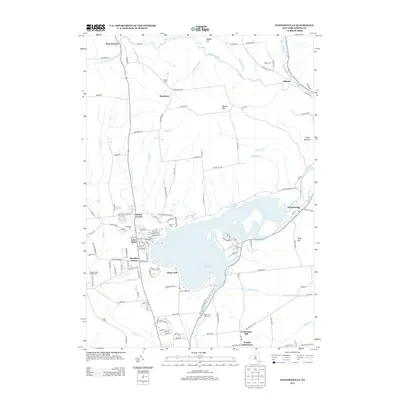
2013 Map of Westernville
USGS Topo · Published 2013About this map
Delta Reservoir dominates this Central New York landscape, a massive water body that reshaped the local topography and replaced earlier settlement patterns. The historic Black River Canal remains a visible thread of 19th-century infrastructure, running alongside the Mohawk River and passing through the village of Westernville. This 2013 survey shows a region defined by its water management and agricultural heritage, with small settlements like Stokes Corner, Hawkins Corner, and Hillside dotting the hillsides. Significant genealogical landmarks are preserved across the quadrangle, including the Welsh Cem near Beartown and the Polish Cem to the south. The presence of the Rome Fish Hatchery near the reservoir’s southern dam and the Sleepy Hollow Golf Course near Wood Cr illustrates the modern shift toward conservation and recreation in a valley once primarily focused on industrial transport and farming.
Find a feature on this map
90 named features on this map. Tap any name to fly to it.
Don’t see what you’re looking for? This feature index may not catch every label — zoom into the map to look around manually.
Map Details
Editions of this 2013 Westernville Map
This is the sole edition of this map. No revisions or reprints were ever made.
Other maps of this area

1895 · Oriskany
USGS Topo · 1:62,500

1895 · Oneida
USGS Topo · 1:62,500

1898 · Oneida
USGS Topo · 1:62,500

1898 · Oriskany
USGS Topo · 1:62,500

1902 · Oneida
USGS Topo · 1:62,500

1904 · Boonville
USGS Topo · 1:62,500

1905 · Taberg
USGS Topo · 1:62,500

1939 · Oneida
USGS Topo · 1:62,500

1943 · Lee Center
USGS Topo · 1:31,680

1944 · Point Rock
USGS Topo · 1:31,680