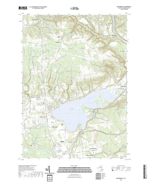
2023 Map of Westernville
USGS Topo · Published 2023About this map
Delta Reservoir dominates the center of this terrain, where the Mohawk River flows into the expansive impoundment. The landscape is marked by the historical path of the Black River Canal, which parallels the Lansing Kill and Dunn Brook RD as it heads toward the settlement of Westernville. This village serves as a focal point for local history, flanked by the Westernville Cem and the rise of Gifford Hill. To the south, the map captures the northern outskirts of Rome, including Wright Settlement and Canterbury Hill. Several family and community burial grounds, such as Welsh Cem and Evergreen Cem, are scattered across the uplands of Quaker Hill and Beartown, providing valuable touchpoints for genealogists tracing the early rural townships of Oneida County.
Find a feature on this map
119 named features on this map. Tap any name to fly to it.
Don’t see what you’re looking for? This feature index may not catch every label — zoom into the map to look around manually.
Map Details
Editions of this 2023 Westernville Map
This is the sole edition of this map. No revisions or reprints were ever made.
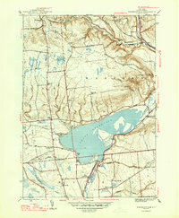
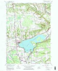
Historical Maps of Elmer Hill Through Time
3 maps found