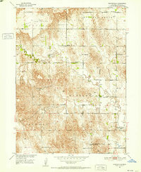
1951 Map of Westerville
USGS Topo · Published 1952About this map
Westerville sits at the intersection of a sprawling rural landscape defined by the winding course of Clear Creek. In the early 1950s, this portion of Custer County maintained a dense network of one-room schoolhouses and small community hubs, reflecting the mid-century agrarian character of the Nebraska Sandhills periphery. The map documents a high density of rural education sites, from Weissert Sch in the northwest to Hanna Corners Sch in the south, suggesting a once-active population of farming families. Local genealogy is well-served by several clearly marked burial grounds, including the French Tableland Cem on the high French Tableland and the Lone Tree Cem near the creek. The presence of numerous Windmills across the townships of Douglas Grove and Berwyn underscores the critical importance of water management in this high-plains environment.
Find a feature on this map
20 named features on this map. Tap any name to fly to it.
Don’t see what you’re looking for? This feature index may not catch every label — zoom into the map to look around manually.
Map Details
Editions of this 1951 Westerville Map
2 editions found
Other maps of this area

1951 · Broken Bow NE
USGS Topo · 1:24,000

1951 · Westerville
USGS Topo · 1:24,000

1951 · Ansley
USGS Topo · 1:24,000

1951 · Broken Bow SE
USGS Topo · 1:24,000

1951 · Ansley NE
USGS Topo · 1:24,000

1951 · Round Valley
USGS Topo · 1:24,000

1951 · Ansley SE
USGS Topo · 1:24,000

1952 · Sargent SE
USGS Topo · 1:24,000

1952 · Sargent SW
USGS Topo · 1:24,000

1955 · Broken Bow
USGS Topo · 1:250,000