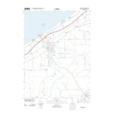
2013 Map of Westfield
USGS Topo · Published 2013About this map
Barcelona sits along the Lake Erie shoreline, serving as a focal point for maritime activity with its East Breakwater Light and Montoes Marina. This coastal landscape transitions inland toward the village of Westfield, where the town's agricultural and social character is documented through sites like Vine City Dairy and local landmarks. The area's heritage is preserved in several grounds, including the Old Saint James Cem and Union Cem, while the terrain is marked by the steep incision of The Gulf along Chautauqua Creek.
Find a feature on this map
105 named features on this map. Tap any name to fly to it.
Don’t see what you’re looking for? This feature index may not catch every label — zoom into the map to look around manually.
Map Details
Editions of this 2013 Westfield Map
This is the sole edition of this map. No revisions or reprints were ever made.
Other maps of this area

1899 · Westfield
USGS Topo · 1:62,500

1900 · Dunkirk
USGS Topo · 1:62,500

1904 · Chautaqua
USGS Topo · 1:62,500

1905 · Clymer
USGS Topo · 1:62,500

1939 · Clymer
USGS Topo · 1:62,500

1941 · Chautauqua
USGS Topo · 1:62,500

1941 · Clymer
USGS Topo · 1:62,500

1943 · Dunkirk
USGS Topo · 1:62,500

1954 · Chautauqua
USGS Topo · 1:24,000

1954 · South Ripley
USGS Topo · 1:24,000