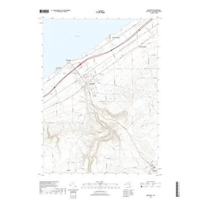
2019 Map of Westfield
USGS Topo · Published 2019About this map
Westfield sits at a critical geographic junction where the steep escapements of the Chautauqua Ridge meet the plains of the Lake Erie shoreline. This landscape is defined by the deep incision of Chautauqua Creek and its many tributaries, such as Bournes Cr and Doty Cr, which carve through the terrain as they descend toward the lake. The village layout follows a historic radial pattern, with Main St and N Portage St serving as primary arteries connecting the lakeside community of Barcelona to the upland interior.
Find a feature on this map
91 named features on this map. Tap any name to fly to it.
Don’t see what you’re looking for? This feature index may not catch every label — zoom into the map to look around manually.
Map Details
Editions of this 2019 Westfield Map
This is the sole edition of this map. No revisions or reprints were ever made.
Other maps of this area

1899 · Westfield
USGS Topo · 1:62,500

1900 · Dunkirk
USGS Topo · 1:62,500

1904 · Chautaqua
USGS Topo · 1:62,500

1905 · Clymer
USGS Topo · 1:62,500

1939 · Clymer
USGS Topo · 1:62,500

1941 · Chautauqua
USGS Topo · 1:62,500

1941 · Clymer
USGS Topo · 1:62,500

1943 · Dunkirk
USGS Topo · 1:62,500

1954 · Chautauqua
USGS Topo · 1:24,000

1954 · South Ripley
USGS Topo · 1:24,000