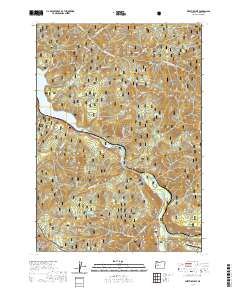
2020 Map of Westfir West
USGS Topo · Published 2020About this map
Willamette National Forest dominates this landscape where the Middle Fork Willamette River flows through deep valleys toward the northern reaches of Lookout Point Lake. The small settlement of Westfir sits at the eastern edge of the map, serving as a gateway to the high ridgelines of Tire Mountain and Cloverpatch Butte. This 2020 survey illustrates the modern intersection of timber legacy and recreation, showing numerous forest routes such as Black Canyon Way and the Black Canyon Nature Trail.
Find a feature on this map
54 named features on this map. Tap any name to fly to it.
Don’t see what you’re looking for? This feature index may not catch every label — zoom into the map to look around manually.
Map Details
Editions of this 2020 Westfir West Map
This is the sole edition of this map. No revisions or reprints were ever made.
Other maps of this area

1925 · Waldo Lake
USGS Topo · 1:125,000

1935 · Lowell
USGS Topo · 1:96,000

1942 · Lowell
USGS Topo · 1:125,000

1955 · Hardesty Mtn
USGS Topo · 1:62,500

1955 · Fairview Peak
USGS Topo · 1:62,500

1956 · Oakridge
USGS Topo · 1:62,500

1956 · Sardine Butte
USGS Topo · 1:62,500

1958 · Roseburg
USGS Topo · 1:250,000

1959 · Roseburg
USGS Topo · 1:250,000

1983 · Oakridge
USGS Topo · 1:100,000