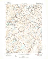
1950 Map of Westford
USGS Topo · Published 1952About this map
Graniteville and Forge Village serve as industrial and social anchors in the mid-century landscape of northern Middlesex County. This 1950 revision illustrates a transition era where the Boston and Maine Railroad and the New York New Haven and Hartford Railroad still defined the movement of people and goods through stations like Brookside Sta and Westford Sta. The terrain is characterized by a dense network of water bodies, from the prominent Nagog Pond and Forge Pond to smaller features like Sought for Pond and Flushing Pond.
Find a feature on this map
71 named features on this map. Tap any name to fly to it.
Don’t see what you’re looking for? This feature index may not catch every label — zoom into the map to look around manually.
Map Details
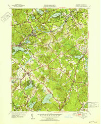
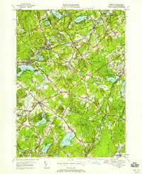
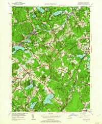
Editions of this 1950 Westford Map
4 editions found
Other maps of this area

1886 · Lowell
USGS Topo · 1:62,500

1886 · Framingham
USGS Topo · 1:62,500

1887 · Marlboro
USGS Topo · 1:62,500

1889 · Marlboro
USGS Topo · 1:62,500

1889 · Framingham
USGS Topo · 1:62,500

1893 · Lowell
USGS Topo · 1:62,500

1893 · Groton
USGS Topo · 1:62,500

1894 · Framingham
USGS Topo · 1:62,500

1896 · Marlboro
USGS Topo · 1:62,500

1898 · Marlboro
USGS Topo · 1:62,500