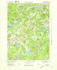
1966 Map of Westford
USGS Topo · Published 1979About this map
Graniteville and Forge Village serve as industrial and residential anchors along the Boston and Maine Railroad, which cuts a path through this part of Middlesex County. The landscape is a dense network of water and topography, where Stony Brook and Nagog Pond sit alongside numerous drumlins like Millstone Hill and Prospect Hill. Educational and social hubs are clearly marked, including the historic Westford Academy and the Nashoba Club near Littleton Common. The presence of several gravel pits and a Quarry suggests the importance of local mineral extraction to the regional economy during the mid-twentieth century. Settlement patterns follow the winding routes of Concord Road and Littleton Road, connecting established village centers with newer residential developments. Local genealogists will find value in the detailed locations of burial grounds such as Fairview Cem and Russian Cem, providing a window into the community's ancestral footprint.
Find a feature on this map
117 named features on this map. Tap any name to fly to it.
Don’t see what you’re looking for? This feature index may not catch every label — zoom into the map to look around manually.
Map Details
Editions of this 1966 Westford Map
2 editions found
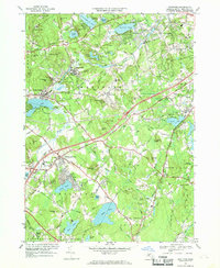
Other maps of this area

1886 · Lowell
USGS Topo · 1:62,500

1886 · Framingham
USGS Topo · 1:62,500

1887 · Marlboro
USGS Topo · 1:62,500

1889 · Marlboro
USGS Topo · 1:62,500

1889 · Framingham
USGS Topo · 1:62,500

1893 · Lowell
USGS Topo · 1:62,500

1893 · Groton
USGS Topo · 1:62,500

1894 · Framingham
USGS Topo · 1:62,500

1896 · Marlboro
USGS Topo · 1:62,500

1898 · Marlboro
USGS Topo · 1:62,500