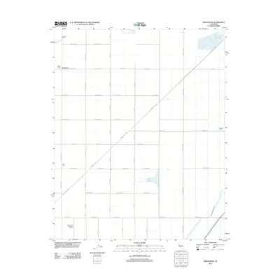
2012 Map of Westhaven
USGS Topo · Published 2012About this map
Westhaven and its surrounding agricultural landscape are defined by a rigid grid of county roads and vital water infrastructure in the San Joaquin Valley. This 2012 survey illustrates the importance of irrigation to the local economy, tracing the paths of the Empire Westside Ditch and Blakeley Canal as they navigate the flat terrain. The map records a series of established agricultural properties, including the Boston Ranch, Stratford Ranch, and Allen Ranch, which stand as significant landmarks amidst the expanse of fields.
Find a feature on this map
29 named features on this map. Tap any name to fly to it.
Don’t see what you’re looking for? This feature index may not catch every label — zoom into the map to look around manually.
Map Details
Editions of this 2012 Westhaven Map
This is the sole edition of this map. No revisions or reprints were ever made.
Other maps of this area

1912 · Coalinga
USGS Topo · 1:125,000

1926 · Lethent
USGS Topo · 1:31,680

1927 · Lemoore
USGS Topo · 1:31,680

1929 · Stratford
USGS Topo · 1:31,680

1929 · Westhaven
USGS Topo · 1:31,680

1930 · Discovery Well
USGS Topo · 1:31,680

1932 · West of Lethent
USGS Topo · 1:31,680

1933 · Kettleman City
USGS Topo · 1:31,680

1933 · Huron
USGS Topo · 1:31,680

1933 · Chatom Ranch
USGS Topo · 1:31,680