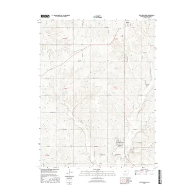
2015 Map of Westmoreland
USGS Topo · Published 2015About this map
Westmoreland serves as the focal point of this Kansas landscape, situated where the grid of rural roads meets the winding path of Rock Cr. The map reveals a deeply rooted community, evidenced by the high density of burial grounds including Old Westmoreland Cem and the contemporary Westmoreland Cem. To the north, the small settlement of Blaine anchors the corner of the survey near Saint Columkilles Cem. The terrain is defined by a network of drainages such as Wilson Cr and Bucksnort Cr, which carve through the countryside toward landmarks like Mt Ephraim. Local thoroughfares, including Huff Rd and Bigelow Rd, link isolated family-named landmarks like Huff Cem and Moodyville Cem, providing a clear picture of the modern road network superimposed over a historical pattern of rural settlement and land use in Pottawatomie County.
Find a feature on this map
42 named features on this map. Tap any name to fly to it.
Don’t see what you’re looking for? This feature index may not catch every label — zoom into the map to look around manually.
Map Details
Editions of this 2015 Westmoreland Map
This is the sole edition of this map. No revisions or reprints were ever made.
Other maps of this area

1886 · Junction City
USGS Topo · 1:125,000

1889 · Seneca
USGS Topo · 1:125,000

1889 · Wamego
USGS Topo · 1:125,000

1889 · Marysville
USGS Topo · 1:125,000

1889 · Junction City
USGS Topo · 1:125,000

1894 · Junction City
USGS Topo · 1:125,000

1894 · Seneca
USGS Topo · 1:125,000

1894 · Marysville
USGS Topo · 1:125,000

1894 · Wamego
USGS Topo · 1:125,000

1955 · Manhattan
USGS Topo · 1:250,000