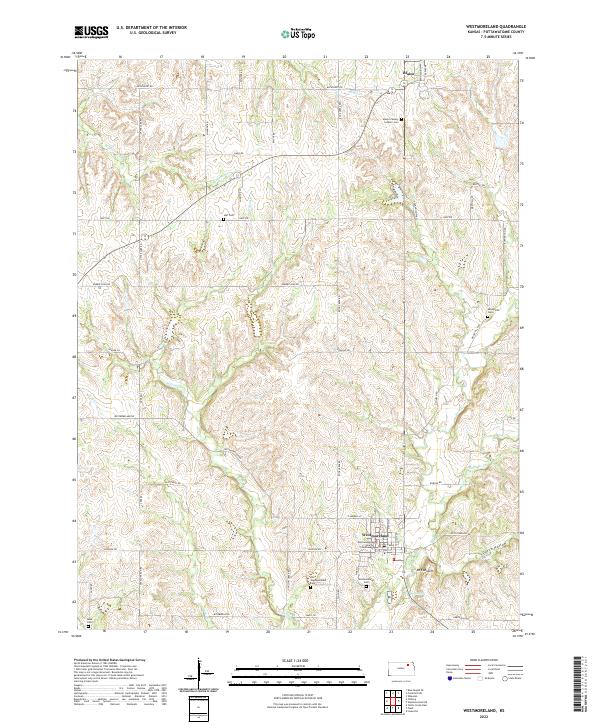
2022 Map of Westmoreland
USGS Topo · Published 2022About this map
Westmoreland serves as the focal point of this northern Kansas survey, centered around the Pottawatomie County Courthouse and its surrounding grid. The landscape is defined by the branching drainages of the Rock Cr and Bucksnort Cr systems, which create a dissected terrain of ridges and valleys. Small-scale rural settlement patterns are visible through several family and community burial grounds, including the Old Westmoreland Cem and the Mount Calvary Catholic Cem located near Blaine. The map illustrates a transition from the structured street plan of the county seat to the winding gravel roads that follow natural contours, such as Dutch Hollow Rd and Roberts Run Rd. Landmarks like Mt Ephraim and Scott Spring provide specific reference points for those studying the local topography and historical land use in this part of the Flint Hills region.
Find a feature on this map
61 named features on this map. Tap any name to fly to it.
Don’t see what you’re looking for? This feature index may not catch every label — zoom into the map to look around manually.
Map Details
Editions of this 2022 Westmoreland Map
This is the sole edition of this map. No revisions or reprints were ever made.
Other maps of this area

1886 · Junction City
USGS Topo · 1:125,000

1889 · Seneca
USGS Topo · 1:125,000

1889 · Wamego
USGS Topo · 1:125,000

1889 · Marysville
USGS Topo · 1:125,000

1889 · Junction City
USGS Topo · 1:125,000

1894 · Junction City
USGS Topo · 1:125,000

1894 · Seneca
USGS Topo · 1:125,000

1894 · Marysville
USGS Topo · 1:125,000

1894 · Wamego
USGS Topo · 1:125,000

1955 · Manhattan
USGS Topo · 1:250,000