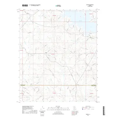
2018 Map of Weston
USGS Topo · Published 2018About this map
Weston and Walker anchor this northern Louisiana landscape, which is defined by the expansive northern reaches of Caney Creek Reservoir. This 2018 survey reveals the intricate drainage network feeding into the reservoir, including Dry Cr and Peepee Br, while the southern portion of the sheet spans the boundary between Jackson Parish and Winn Parish. The area is threaded with numerous parish roads, such as Parish Rd 477 and Parish Rd 464, which connect scattered rural residences and family landmarks.
Find a feature on this map
97 named features on this map. Tap any name to fly to it.
Don’t see what you’re looking for? This feature index may not catch every label — zoom into the map to look around manually.
Map Details
Editions of this 2018 Weston Map
This is the sole edition of this map. No revisions or reprints were ever made.
Other maps of this area

1949 · Jonesboro
USGS Topo · 1:62,500

1950 · Jonesboro
USGS Topo · 1:62,500

1953 · Chatham
USGS Topo · 1:62,500

1953 · Hodge
USGS Topo · 1:62,500

1954 · Sikes
USGS Topo · 1:62,500

1955 · Shreveport
USGS Topo · 1:250,000

1956 · Shreveport
USGS Topo · 1:250,000

1982 · Chatham
USGS Topo · 1:24,000

1984 · Shreveport
USGS Topo · 1:250,000
1985 · Monroe South
USGS Topo · 1:100,000