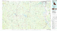
1985 Map of Monroe South
USGS Topo · Published 1985About this map
The Dugdemona River basin and the surrounding pine-rich parishes of North Central Louisiana define this mid-1980s landscape. Industrial and agricultural lifelines are prominent, with the Illinois Central Gulf RR and Midsouth Railroad corridors connecting timber and trade centers like Jonesboro, Hodge, and Quitman. The creation of the Coney Creek Reservoir east of Jonesboro stands out as a significant hydrological feature, contrasting with the natural meandering paths of Saline Creek and Cypress Creek.
Find a feature on this map
166 named features on this map. Tap any name to fly to it.
Don’t see what you’re looking for? This feature index may not catch every label — zoom into the map to look around manually.
Map Details
Editions of this 1985 Monroe South Map
2 editions found
Other maps of this area

1935 · Collinston
USGS Topo · 1:62,500

1935 · Alto
USGS Topo · 1:62,500

1935 · Drew
USGS Topo · 1:62,500

1937 · Campti NE
USGS Topo · 1:31,680

1939 · Fort Necessity
USGS Topo · 1:62,500

1940 · Monroe
USGS Topo · 1:62,500

1940 · Columbia
USGS Topo · 1:62,500

1941 · Harrisonburg
USGS Topo · 1:62,500

1944 · Campti
USGS Topo · 1:62,500

1947 · Goldonna
USGS Topo · 1:62,500