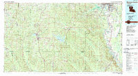
1985 Map of Monroe South
USGS Topo · Published 1988About this map
The Ouachita River corridor dominates the eastern landscape of this 1980s survey, anchoring a network of river-bottom settlements including Bawcomville, Logtown, and De Loach. This era captures the region's heavy reliance on both water and rail transportation, with the Missouri Pacific RR and Illinois Central Gulf RR threading through the timberlands. To the west, the expansive Kisatchie National Forest and the Caney Creek Reservoir illustrate the transition from industrial river valley to managed natural resources and recreation.
Find a feature on this map
110 named features on this map. Tap any name to fly to it.
Don’t see what you’re looking for? This feature index may not catch every label — zoom into the map to look around manually.
Map Details
Editions of this 1985 Monroe South Map
2 editions found
Other maps of this area

1935 · Collinston
USGS Topo · 1:62,500

1935 · Alto
USGS Topo · 1:62,500

1935 · Drew
USGS Topo · 1:62,500

1937 · Campti NE
USGS Topo · 1:31,680

1939 · Fort Necessity
USGS Topo · 1:62,500

1940 · Monroe
USGS Topo · 1:62,500

1940 · Columbia
USGS Topo · 1:62,500

1941 · Harrisonburg
USGS Topo · 1:62,500

1944 · Campti
USGS Topo · 1:62,500

1947 · Goldonna
USGS Topo · 1:62,500