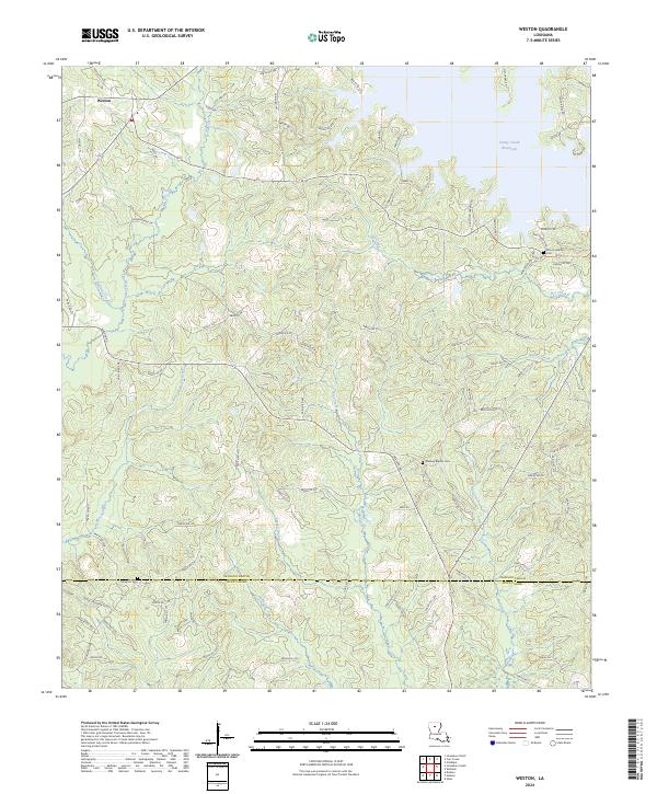
2024 Map of Weston
USGS Topo · Published 2024About this map
Weston sits at a crossing of rural parish roads in this part of North Louisiana, where the landscape is defined by the headwaters of numerous creeks and the southern reaches of the Caney Creek Reservoir. This 2024 survey captures a terrain shaped by water and timber, with the Jackson Parish and Winn Parish line cutting east-to-west across the lower third of the map. The distribution of cemeteries, such as Midway Baptist Cem and Mount Hebron Cem, suggests the historical locations of small congregations and family settlements that have anchored these pinewoods for generations. The road network, including Hummingbird Dr and numerous numbered parish routes like Parish Rd 475, follows the natural contours of the drainage basins for Hurricane Creek and Beech Creek, reflecting a land use pattern focused on rural homesteads and resource management.
Find a feature on this map
98 named features on this map. Tap any name to fly to it.
Don’t see what you’re looking for? This feature index may not catch every label — zoom into the map to look around manually.
Map Details
Editions of this 2024 Weston Map
This is the sole edition of this map. No revisions or reprints were ever made.
Other maps of this area

1949 · Jonesboro
USGS Topo · 1:62,500

1950 · Jonesboro
USGS Topo · 1:62,500

1953 · Chatham
USGS Topo · 1:62,500

1953 · Hodge
USGS Topo · 1:62,500

1954 · Sikes
USGS Topo · 1:62,500

1955 · Shreveport
USGS Topo · 1:250,000

1956 · Shreveport
USGS Topo · 1:250,000

1982 · Chatham
USGS Topo · 1:24,000

1984 · Shreveport
USGS Topo · 1:250,000
1985 · Monroe South
USGS Topo · 1:100,000