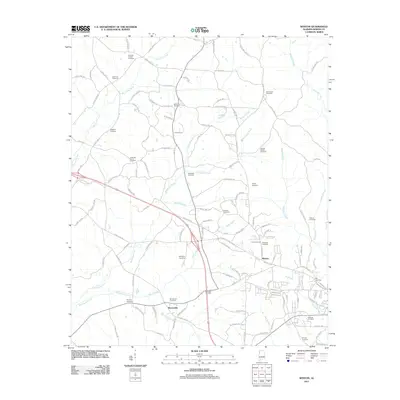
2011 Map of Weston
USGS Topo · Published 2011About this map
Weston and the nearby community of Barnesville anchor this 2011 survey of Marion County, illustrating a landscape defined by its creek valleys and numerous family burying grounds. The terrain is partitioned by watercourses such as Hurricane Creek and Boardtree Creek, which dictate the winding paths of rural routes like County Hwy-157 and County Hwy-11. A high concentration of cemeteries, including the Cockrell-Cofield Cemetery, Nix Chapel Cemetery, and Lockridge Family Cemetery, provides significant data for genealogists and local historians tracing the settlement patterns of this Alabama region. The transition from the rural northern creek branches to the more organized street grid of Weston, featuring names like Briarwood Ave and Regency Pl, reflects the slow expansion of residential life into the traditional timber and farm lands of the south.
Find a feature on this map
125 named features on this map. Tap any name to fly to it.
Don’t see what you’re looking for? This feature index may not catch every label — zoom into the map to look around manually.
Map Details
Editions of this 2011 Weston Map
This is the sole edition of this map. No revisions or reprints were ever made.
Other maps of this area

1936 · Hodges
USGS Topo · 1:24,000

1936 · Vina
USGS Topo · 1:24,000

1949 · Hodges
USGS Topo · 1:24,000

1950 · Vina
USGS Topo · 1:24,000

1951 · Vina
USGS Topo · 1:24,000

1956 · Gadsden
USGS Topo · 1:250,000

1956 · Tupelo
USGS Topo · 1:250,000

1958 · Tupelo
USGS Topo · 1:250,000

1958 · Gadsden
USGS Topo · 1:250,000

1960 · Gadsden
USGS Topo · 1:250,000