
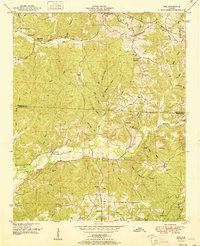
1951 Map of Vina
USGS Topo · Published 1951About this map
The Tennessee Valley Divide snakes through the landscape of northwest Alabama, separating the headwaters of numerous creeks that define the local geography. Following the ridge line of this divide, the Illinois Central Railroad connects the settlements of Vina and Atwood, highlighting the importance of rail transit in this rural region during the mid-century. The map captures a high density of community centers including Hurricane Sch, Newburg Sch, and several houses of worship such as Good Spring Church and Pilot Hill Ch.
Find a feature on this map
62 named features on this map. Tap any name to fly to it.
Don’t see what you’re looking for? This feature index may not catch every label — zoom into the map to look around manually.
Map Details
Editions of this 1951 Vina Map
2 editions found
Other maps of this area

1936 · Hodges
USGS Topo · 1:24,000

1936 · Red Bay
USGS Topo · 1:24,000

1936 · Vina
USGS Topo · 1:24,000

1936 · Halltown
USGS Topo · 1:24,000

1936 · Guinn Cross Roads
USGS Topo · 1:24,000
1946 · Guinn Cross Roads
USGS Topo · 1:24,000
1947 · Guinn Cross Roads
USGS Topo · 1:24,000

1949 · Hodges
USGS Topo · 1:24,000

1950 · Vina
USGS Topo · 1:24,000
1950 · Halltown
USGS Topo · 1:24,000