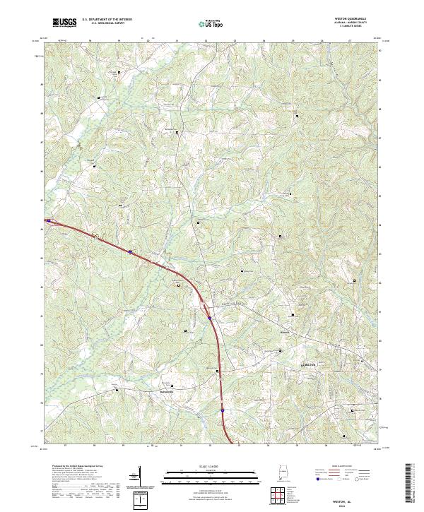
2024 Map of Weston
USGS Topo · Published 2024About this map
The northern reaches of Hamilton and the surrounding Marion County countryside are defined by a complex network of creeks and small family cemeteries. The landscape is carved by water, with Hurricane Creek flowing through the northwest and Watts Creek cutting across the southern sections near Barnesville. This territory reflects a deep-rooted pattern of rural settlement where small communities like Weston grew alongside long-established family burial grounds.
Find a feature on this map
145 named features on this map. Tap any name to fly to it.
Don’t see what you’re looking for? This feature index may not catch every label — zoom into the map to look around manually.
Map Details
Editions of this 2024 Weston Map
This is the sole edition of this map. No revisions or reprints were ever made.
Other maps of this area

1936 · Hodges
USGS Topo · 1:24,000

1936 · Vina
USGS Topo · 1:24,000

1949 · Hodges
USGS Topo · 1:24,000

1950 · Vina
USGS Topo · 1:24,000

1951 · Vina
USGS Topo · 1:24,000

1956 · Gadsden
USGS Topo · 1:250,000

1956 · Tupelo
USGS Topo · 1:250,000

1958 · Tupelo
USGS Topo · 1:250,000

1958 · Gadsden
USGS Topo · 1:250,000

1960 · Gadsden
USGS Topo · 1:250,000