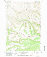
1964 Map of Weston Mountain
USGS Topo · Published 1983About this map
Lincton Mountain and Basket Mountain dominate this mid-century topographic portrait of the Blue Mountain foothills in Umatilla County. The landscape is defined by deep drainages such as Scott Canyon and Keseberg Canyon that carve through the high ridges. In the center of the sheet, the small settlement of Waldo sits along a winding road that traverses Weston Mountain. This period of the 1960s shows a transitional mountain economy, evidenced by the presence of a Radio Facility on a high peak and several Gravel Pits tucked near the ridges.
Find a feature on this map
32 named features on this map. Tap any name to fly to it.
Don’t see what you’re looking for? This feature index may not catch every label — zoom into the map to look around manually.
Map Details
Editions of this 1964 Weston Mountain Map
3 editions found
Other maps of this area

1953 · Pendleton
USGS Topo · 1:250,000

1956 · Pendleton
USGS Topo · 1:250,000

1963 · Bingham Springs
USGS Topo · 1:24,000

1963 · Blalock Mountain
USGS Topo · 1:24,000

1963 · Peterson Ridge
USGS Topo · 1:24,000

1964 · Milton-Freewater
USGS Topo · 1:24,000

1964 · Thorn Hollow
USGS Topo · 1:24,000

1964 · Athena
USGS Topo · 1:24,000

1964 · Bowlus Hill
USGS Topo · 1:24,000

1964 · Weston Mountain
USGS Topo · 1:24,000