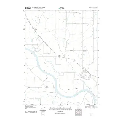
2009 Map of Weston
USGS Topo · Published 2009About this map
The Missouri River dictates the landscape of this Missouri-Kansas borderlands survey, winding through significant bends and creating landforms like Harpst Island and Kickapoo Island. The town of Weston is a primary focal point, showing a developed street grid that includes Main St and Walnut St, alongside several burial grounds such as Lawn Hill Cemetery and Graceland Cemetery. Across the river in Kansas, the settlement of Kickapoo and the Sherman Army Airfield mark the western bank, connected to the broader region by the BNSF Railway. The low-lying alluvial plain known as Fancy Bottom sits between the river and the bluffs, illustrating the complex geography of the river's floodplains. To the north, smaller settlements like Iatan, Sadler, and Dye are linked by a network of rural routes such as Dye Store Rd and Salem Rd.
Find a feature on this map
67 named features on this map. Tap any name to fly to it.
Don’t see what you’re looking for? This feature index may not catch every label — zoom into the map to look around manually.
Map Details
Editions of this 2009 Weston Map
This is the sole edition of this map. No revisions or reprints were ever made.
Other maps of this area

1885 · Atchison
USGS Topo · 1:125,000

1886 · Oskaloosa
USGS Topo · 1:125,000

1888 · Oskaloosa
USGS Topo · 1:125,000

1888 · Atchison
USGS Topo · 1:125,000

1890 · Kansas City
USGS Topo · 1:125,000

1893 · Atchison
USGS Topo · 1:125,000

1894 · Kansas City
USGS Topo · 1:125,000

1894 · Oskaloosa
USGS Topo · 1:125,000

1910 · Leavenworth
USGS Topo · 1:62,500

1926 · Atchison
USGS Topo · 1:62,500