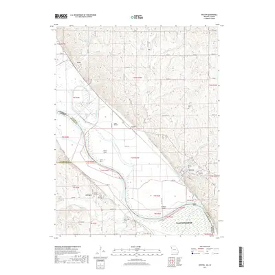
2017 Map of Weston
USGS Topo · Published 2017About this map
The Missouri River snakes along the state line between Missouri and Kansas, shaping a landscape of broad alluvial plains and prominent river bends. On the Missouri side, the town of Weston sits near the base of the river bluffs, overlooking Weston Bend and the fertile lowlands of Fancy Bottom. To the north, the small settlement of Iatan is situated near Latan Bend, where the BNSF Railway follows the river corridor. Across the water in Kansas, the community of Kickapoo is established on the higher ground of the Salt Creek Valley, a region rich with local heritage evidenced by the Kickapoo Sacred Heart Cem and Kickapoo Memorial Cem. The map detail shows the intricate network of chutes and islands, such as Harpst Chute and Kickapoo Island, which characterize this dynamic stretch of the Missouri riverfront during the early twenty-first century.
Find a feature on this map
96 named features on this map. Tap any name to fly to it.
Don’t see what you’re looking for? This feature index may not catch every label — zoom into the map to look around manually.
Map Details
Editions of this 2017 Weston Map
This is the sole edition of this map. No revisions or reprints were ever made.
Other maps of this area

1885 · Atchison
USGS Topo · 1:125,000

1886 · Oskaloosa
USGS Topo · 1:125,000

1888 · Oskaloosa
USGS Topo · 1:125,000

1888 · Atchison
USGS Topo · 1:125,000

1890 · Kansas City
USGS Topo · 1:125,000

1893 · Atchison
USGS Topo · 1:125,000

1894 · Kansas City
USGS Topo · 1:125,000

1894 · Oskaloosa
USGS Topo · 1:125,000

1910 · Leavenworth
USGS Topo · 1:62,500

1926 · Atchison
USGS Topo · 1:62,500