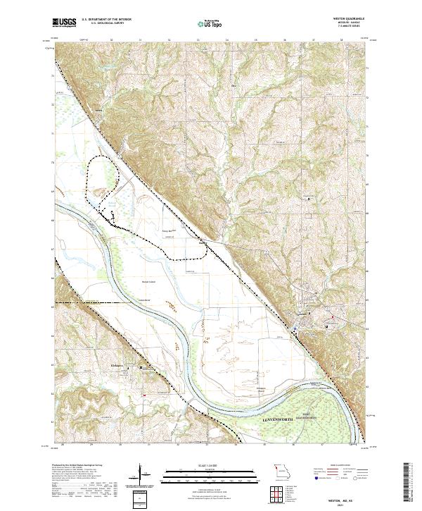
2021 Map of Weston
USGS Topo · Published 2021About this map
Weston anchors the eastern bank of the Missouri River in this 2021 study, revealing a landscape shaped by the shifting waters that define the border between Missouri and Kansas. The river's influence is evident in the presence of Harpst Island and the prominent bend at Iatan Bend, while older channels like Harpst Chute and Wellson Slough indicate the complex hydrography of this fertile river valley. To the west, the community of Kickapoo and its associated landmarks, including the Kickapoo Memorial Cem and Kickapoo Sacred Heart Cem, speak to the deep-rooted cultural geography of the area.
Find a feature on this map
90 named features on this map. Tap any name to fly to it.
Don’t see what you’re looking for? This feature index may not catch every label — zoom into the map to look around manually.
Map Details
Editions of this 2021 Weston Map
This is the sole edition of this map. No revisions or reprints were ever made.
Other maps of this area

1885 · Atchison
USGS Topo · 1:125,000

1886 · Oskaloosa
USGS Topo · 1:125,000

1888 · Oskaloosa
USGS Topo · 1:125,000

1888 · Atchison
USGS Topo · 1:125,000

1890 · Kansas City
USGS Topo · 1:125,000

1893 · Atchison
USGS Topo · 1:125,000

1894 · Kansas City
USGS Topo · 1:125,000

1894 · Oskaloosa
USGS Topo · 1:125,000

1910 · Leavenworth
USGS Topo · 1:62,500

1926 · Atchison
USGS Topo · 1:62,500