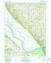
1984 Map of Weston
USGS Topo · Published 1984About this map
Missouri River meanders define the border between Missouri and Kansas here, creating a complex landscape of chutes and islands such as Weston Island and Kickapoo Island. The town of Weston is the primary settlement, situated near the dramatic curve of Weston Bend and the established Weston Bend State Park. To the south, the map documents a portion of the Fort Leavenworth Military Reservation, including the Sherman Army Airfield situated on the river's western floodplain.
Find a feature on this map
43 named features on this map. Tap any name to fly to it.
Don’t see what you’re looking for? This feature index may not catch every label — zoom into the map to look around manually.
Map Details
Editions of this 1984 Weston Map
This is the sole edition of this map. No revisions or reprints were ever made.
Other maps of this area

1885 · Atchison
USGS Topo · 1:125,000

1886 · Oskaloosa
USGS Topo · 1:125,000

1888 · Oskaloosa
USGS Topo · 1:125,000

1888 · Atchison
USGS Topo · 1:125,000

1890 · Kansas City
USGS Topo · 1:125,000

1893 · Atchison
USGS Topo · 1:125,000

1894 · Kansas City
USGS Topo · 1:125,000

1894 · Oskaloosa
USGS Topo · 1:125,000

1910 · Leavenworth
USGS Topo · 1:62,500

1926 · Atchison
USGS Topo · 1:62,500