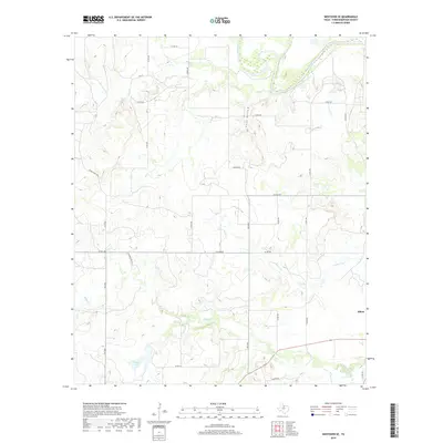
2019 Map of Westover SE
USGS Topo · Published 2019About this map
The Brazos River meanders across the northern reaches of this Throckmorton County landscape, carving a valley that defines the local drainage patterns. In the southeastern corner, the settlement of Elbert serves as the primary point of human concentration, situated at the intersection of rural routes and the headwaters of local creeks. The terrain is a network of seasonal watercourses including Leopard Cr and Boggy Cr, which feed into larger bodies like Keeter Lake.
Find a feature on this map
28 named features on this map. Tap any name to fly to it.
Don’t see what you’re looking for? This feature index may not catch every label — zoom into the map to look around manually.
Map Details
Editions of this 2019 Westover SE Map
This is the sole edition of this map. No revisions or reprints were ever made.
Other maps of this area

1954 · Wichita Falls
USGS Topo · 1:250,000

1958 · Wichita Falls
USGS Topo · 1:250,000

1963 · Megargel
USGS Topo · 1:24,000

1964 · Padgett
USGS Topo · 1:24,000

1965 · Throckmorton NE
USGS Topo · 1:24,000

1966 · Westover SE
USGS Topo · 1:24,000

1966 · Rock Canyon
USGS Topo · 1:24,000

1966 · Westover SW
USGS Topo · 1:24,000
1966 · Throckmorton
USGS Topo · 1:24,000
1966 · Westover
USGS Topo · 1:24,000